
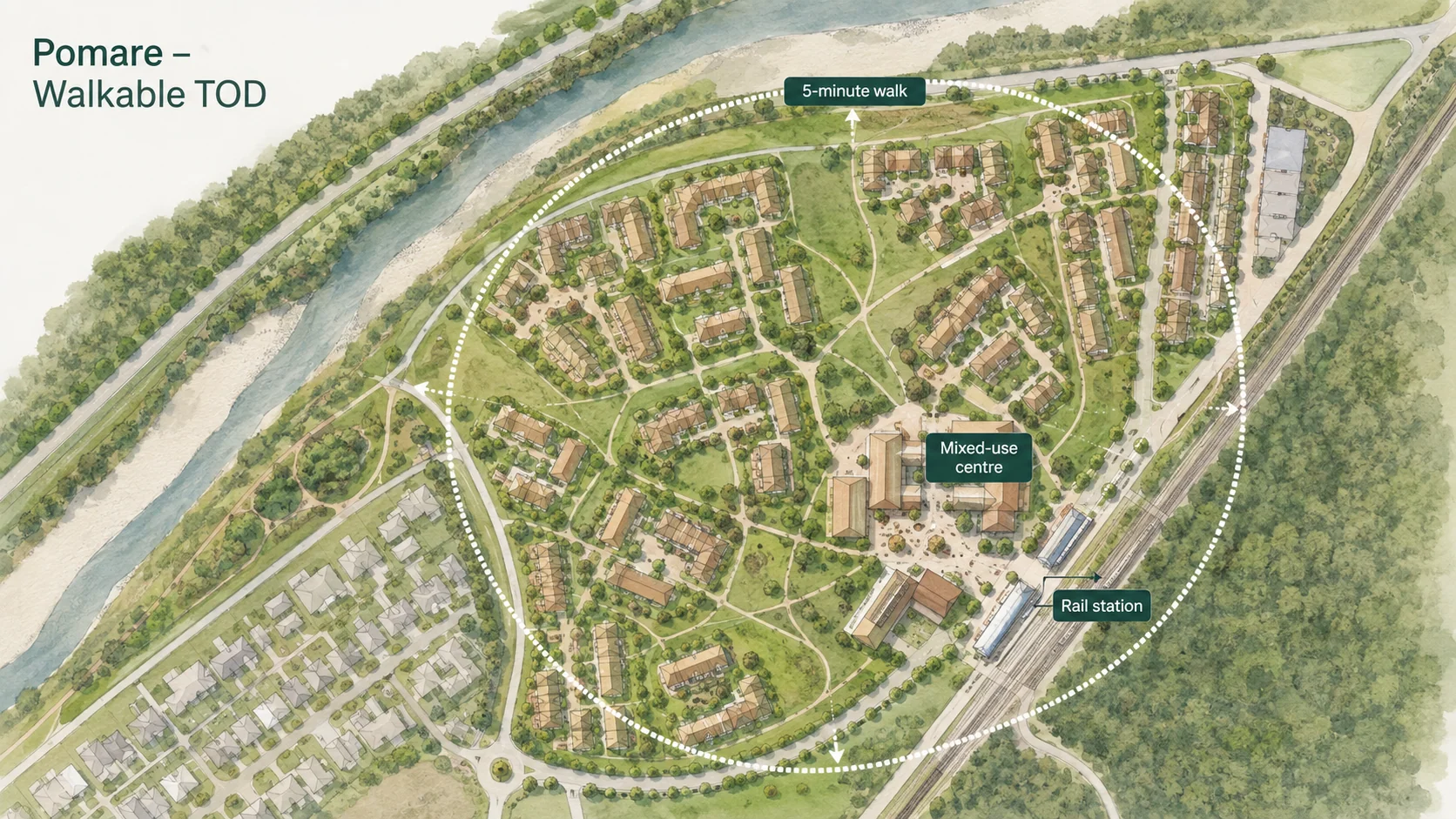
Pomare walkable transit-oriented development concept plan organised around a rail station, mixed-use centre and five-minute walk
← Masterplanning projects

Masterplanning · Conceptual urban study · Pomare

Walkable Urbanism - Transit-Oriented Development

A compact neighbourhood structure in which enough people, homes and everyday destinations are brought within an easy walk of a mixed-use centre and rail station to make walking and public transport genuinely convenient.

The proposition

Density is purposeful, not an end in itself

Compact development + 5-minute walk + mixed-use centre + rail station = walkable TOD.

The Pomare study explores a simple urban-design proposition: higher density, mixed use and public transport work best when they are arranged within a genuinely walkable spatial structure. It is more than putting houses near a railway station. The aim is to create a compact neighbourhood ecosystem in which homes, shops, community facilities, recreation and public transport reinforce one another.

The rail station and mixed-use community hub form the principal focus. Housing is concentrated within a walkable catchment, with pedestrian routes converging on the centre so that daily trips can be made on foot rather than by car.

Walking also does more than improve transport efficiency. People moving through the neighbourhood on foot create the repeated casual encounters that help public and communal spaces become active parts of everyday life.

01FAR 0.8 minimum 02Five-minute walk 03Mixed-use centre 04Rail integrated with the centre 05Clustered housing + shared space

Density and viability

Floor Area Ratio: enough density to support walkable urbanism

Density has to be high enough to support frequent public transport, local shops, services and everyday pedestrian activity.

Floor Area Ratio (FAR) measures the amount of building floor area relative to the land area. A FAR of 0.8 means that total floor area is equal to 80% of the gross site area being measured.

The earlier Pomare study contrasted conventional suburban development at about FAR 0.18 with a more compact walkable form at approximately FAR 0.8. For this TOD concept, FAR 0.8 is treated as a minimum benchmark for the walkable neighbourhood structure.

The point is not density for its own sake. Sufficient density puts enough people within walking distance to help sustain rail and bus services, shops, community facilities and other local destinations.

Minimum target FAR 0.8

A minimum level of compactness intended to support a viable walkable, mixed-use, transit-oriented neighbourhood.

Walkable urban structure

Distance matters

A destination may be technically nearby, but what matters is whether it is genuinely convenient to reach on foot.

01

Five-minute neighbourhood

Put everyday life within walking distance.

The Pomare concept uses the five-minute walking catchment as a practical organising device. Compact housing is concentrated around the rail station and mixed-use centre, with schools, recreation, community facilities and local services connected through a fine-grained pedestrian network.

The larger neighbourhood catchment and the tighter centre around the rail station create a useful hierarchy: neighbourhood → centre → transit/community hub. The whole development is therefore structured around movement on foot rather than being spatially uniform.
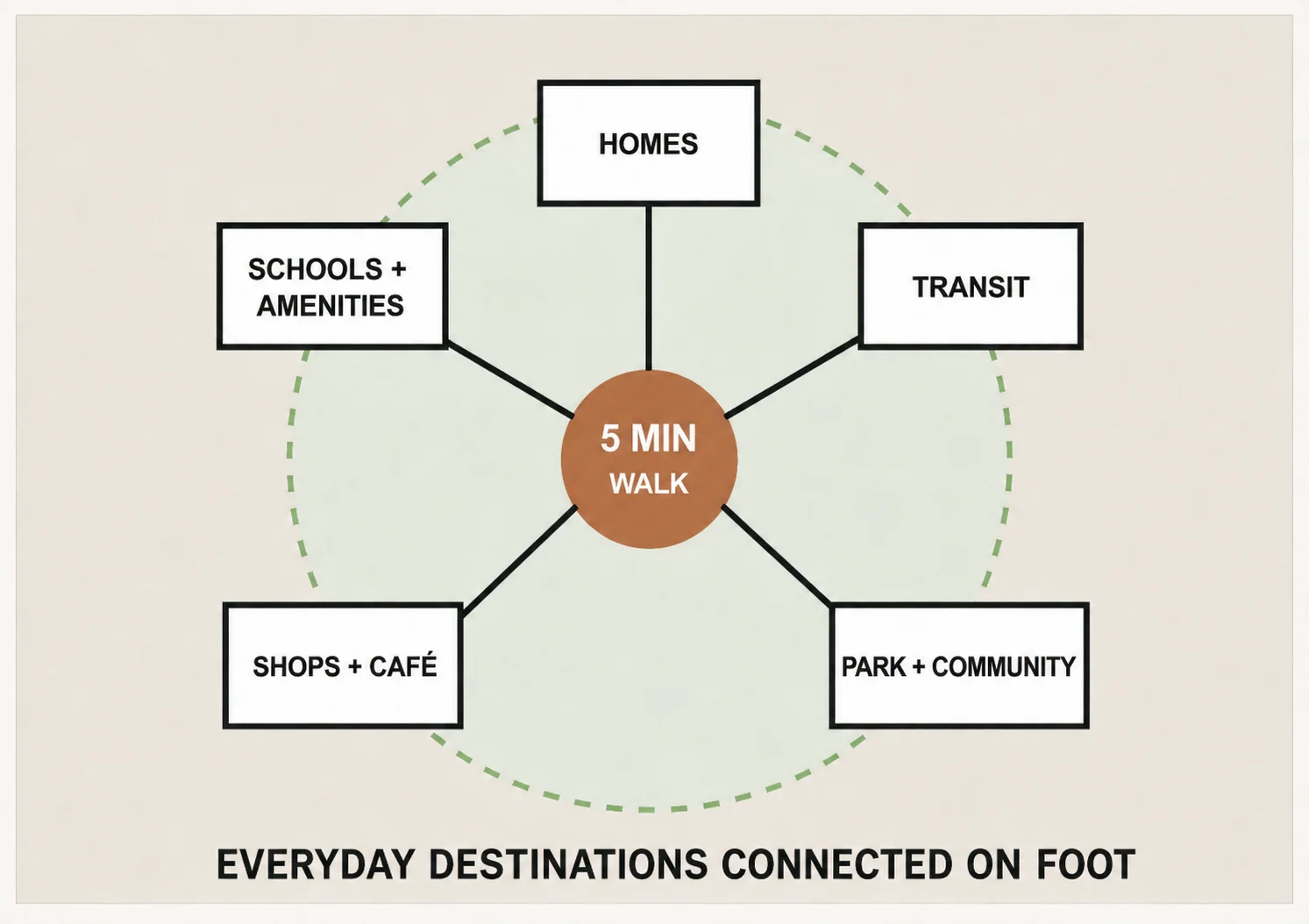
Diagram showing homes, transit, shops and community facilities connected within a five-minute walk
Daily destinations work best when walking is genuinely convenient.
Pomare – Walkable TOD: concept plan showing the five-minute walking catchment, mixed-use centre and rail station.

Mixed use + transit

The station is part of the neighbourhood centre

Transit works best when it is integrated with daily life rather than treated as an isolated transport facility.

Mixed use is essential

If housing is separated from employment, shops, schools and recreation, residents remain dependent on cars even when housing density increases. The Pomare concept therefore brings different uses together around the centre.

Transit is not an afterthought

The rail station is integrated with the mixed-use community hub. This makes public transport part of the neighbourhood's everyday focus and gives people reasons to walk to the centre throughout the day.

The combined proposition

Urban structure first, liveability within it

The Pomare TOD concept and the later Evergreen Crescent work operate at two complementary scales. Pomare establishes the broader structure: compact settlement, sufficient density, walkability, mixed use and transit. Evergreen Crescent effectively zooms into the housing neighbourhood and asks how the communal spaces within that compact structure can support privacy, open space, activity and community.

Put together, the proposition is straightforward: first create enough density within a genuinely walkable transit catchment; then make that density a better place to live by clustering housing around high-quality, multivalent shared outdoor space.

Walkable urbanism is therefore both quantitative and qualitative. FAR and walking distance establish the critical urban structure. The design of housing clusters, thresholds and communal space determines the quality of everyday life within it.

Masterplanning

Compact, connected and liveable

For PPL, transit-oriented development is not simply higher density beside a station. It is a coordinated urban structure in which density, walking, transit, mixed uses, housing clusters and shared space work together.

Start a conversation

Planning a project?

Contact Stephen to discuss your site, your brief and the most useful next step.